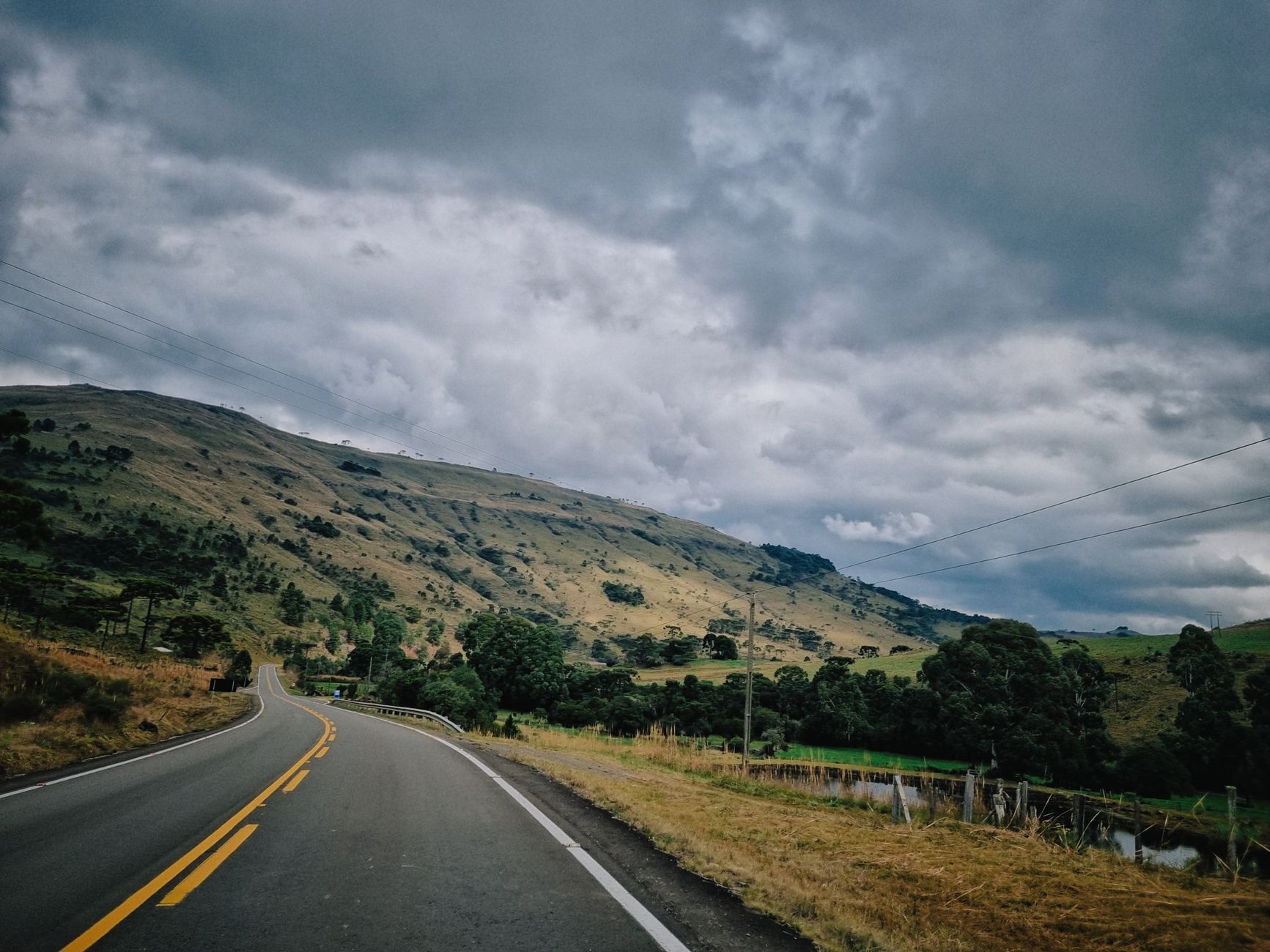
Day 1 morning: Florianópolis to Alfredo Wagner
Leave Florianópolis by 07:30 to clear the BR-282 before the truck traffic thickens. The first 90 kilometres to Rancho Queimado are fast four-lane, then the road narrows and starts climbing. Stop at the Rancho Queimado strawberry stalls at kilometre 85 — R$15 buys a kilo in season (August to November) and the coffee at the roadside padarias is R$4 with a slice of cuca. From here to Alfredo Wagner is another 40 minutes of switchbacks. Do not push past 60 km/h on the descent into the Rio Itajaí valley; the guardrails are new but the drop is real, and the fog often sits in the valley until 10:00.
Alfredo Wagner itself is a fuel-and-lunch town rather than a destination. Fill the tank here — the next reliable posto is 90 kilometres away in Bom Retiro — and eat at one of the buffet-por-quilo places on the main avenue for R$55 a head. The Cascata do Avencal, 12 kilometres off the highway on a graded dirt road, is worth the detour: a 100-metre waterfall with a via ferrata that runs R$180 with a guide. Budget two hours including the drive in and out. Aim to be back on the BR-282 by 14:30 so you reach Urubici with light.
Day 1 afternoon: the climb to Urubici
The stretch from Bom Retiro to Urubici is the prettiest 70 kilometres in the state and the one where drivers make mistakes. The road climbs from 900 to 1,400 metres in a series of horseshoes, and the temperature drops eight degrees on the way up. In July it can be 4°C at the top when it was 18°C at the bottom, so keep a fleece in the passenger footwell rather than the boot. There are two viewpoints worth pulling into: the Morro da Igreja access road at kilometre 217 (a 22-kilometre spur, so save it for Day 2) and the unnamed lay-by at kilometre 231 where the whole Rio Canoas valley opens up.
Arrive in Urubici by 17:00. Sleep at one of the pousadas along the SC-370 towards the Serra do Corvo Branco — the ones roughly two to five kilometres out of town sit on working farms, price around R$380 to R$550 a night with breakfast, and have wood-burning stoves you will use even in March. In town itself the options are cheaper (R$220 to R$300) but you lose the silence and the star view. Dinner is truta — trout — at any of the specialist restaurants near the Praça Anita Garibaldi, R$85 for a whole fish with polenta and salad.
Day 2: Morro da Igreja, Pedra Furada, and the São Joaquim wine road
Start Day 2 at 07:00 to reach the Morro da Igreja gate before the 09:00 fog window closes. The 22-kilometre access road is paved to the park entry (R$25 per person) and then a further two kilometres of rough gravel — a normal car handles it slowly, but avoid it after heavy rain. The Pedra Furada viewpoint sits at 1,822 metres, the highest point in southern Brazil accessible by car, and the natural stone arch frames a straight drop into the Rio Pelotas valley. Allow 90 minutes on site including the walk from the car park. On a clear morning you see 60 kilometres; on a bad one, 20 metres.
Back through Urubici, take the SC-438 towards São Joaquim. This is Brazil's highest wine region, planting Sauvignon Blanc and Pinot Noir above 1,200 metres, and four wineries take walk-ins with an hour's notice. Book Villa Francioni for the architecture (tour and four-wine tasting, R$120), Suzin for the family-run feel (R$60 with cheese board), and eat lunch at whichever has a kitchen open that day. Reach São Joaquim itself by 17:00. Sleep in town at one of the mid-range hotels near Praça João Ribeiro for R$320 a night, or 15 kilometres out at an apple-farm pousada for R$450.
Day 3 morning: Serra do Rio do Rastro
This is the day the route earns its reputation. Leave São Joaquim by 08:00 heading south on the SC-390 towards Bom Jardim da Serra. The town is 40 kilometres and one hour of easy driving; stop at the Mirante da Serra do Rio do Rastro before the descent for coffee (R$6) and to check whether the road below is clear. If you can see the valley floor, go. If the cloud is sitting on the escarpment, wait 40 minutes — it usually lifts by 10:30.
The descent itself is 12 kilometres and drops 1,000 metres in a sequence of hairpins that make the road famous. Do it in second gear the whole way down, do not use the brakes to hold speed (they will fade), and pull into every one of the four signed viewpoints because each frames a different angle of the switchbacks below. Motorcyclists ride this road as a pilgrimage and treat blind corners as their own; give them room. At the bottom, Lauro Müller is unremarkable but has fuel and a decent lunch buffet for R$50.
Day 3 afternoon: back to the coast via Orleans and Tubarão
From Lauro Müller the SC-390 continues through Orleans, where the open-air Museu ao Ar Livre Princesa Isabel holds a working water-driven flour mill and a Sunday German-Italian colonist fair worth 45 minutes if you time it right (entry R$15). Otherwise push through to Tubarão, 60 kilometres of flat farmland driving that takes an easy hour. Tubarão is not a stop, it is a decision point: the BR-101 north back to Florianópolis is 130 kilometres and takes just under two hours in normal traffic, or you can turn south for another 40 minutes and finish the trip on the beach at Garopaba or Praia do Rosa.
If your flight is next-day evening, the beach ending is the better one — you swap a rushed coastal detour for a slow morning by the ocean. Sleep at Rosa in one of the pousadas above the Praia Vermelha, roughly R$480 to R$650 in shoulder season, and drive the final 90 minutes to the airport on Day 4. If you must be back in Florianópolis tonight, aim to leave Tubarão by 15:30 to reach the island before dark; the BR-101 is safer in daylight and the tolls total R$28 in cash or tag.
What the route actually costs
Three days of fuel for a small sedan doing the full 420-kilometre loop plus the Morro da Igreja detour runs about R$380 at current prices. Tolls come to R$52 return. Two nights of mid-range pousada — one in Urubici, one in São Joaquim — total R$780. Three lunches at R$55, two dinners at R$85, and breakfasts included in the room rate put food at R$335. Winery tastings and the Morro da Igreja entry add R$205 per person. That is R$1,752 all in for one traveller, R$2,400 for two sharing a room. Add R$120 a day if you want to eat at the higher-end restaurants in São Joaquim, of which there are three worth the money.
The rental car itself is the variable that changes everything. A basic Onix or Argo out of Florianópolis airport runs R$140 to R$180 a day in low season, R$240 in January. Take the smallest car you fit into — the mountain roads reward a narrow wheelbase and punish anything wider than a Toyota Corolla on the tighter Serra do Rio do Rastro switchbacks. Full insurance is non-negotiable on this route; the rocks on the Morro da Igreja access road eat tyres, and a single sidewall cut on a shared-liability contract costs more than the whole three-day rental.
When to drive this route and when not to
April to June and September to early November are the honest sweet spots. Temperatures at altitude sit between 6°C at night and 20°C by day, the roads are dry, and the fog windows are short enough to plan around. July brings frost, occasional snow at Morro da Igreja, and the tourist crowd that comes to see it — hotel rates double, restaurants need booking a week out, and the Serra do Rio do Rastro sometimes closes for ice. December to March is warm but wet; the switchbacks become genuinely dangerous in heavy rain and the views disappear behind low cloud for days at a time.
Do not attempt this loop in a single long day. It has been done — 14 hours behind the wheel is technically possible — but you will miss every viewpoint that made the roads famous and finish tireder than when you started. Two nights is the minimum. Three nights, adding a second day in Urubici for the Cascata do Rio dos Bugres and the Bugre canyon hike, is the version that sends people home planning a return. Anything longer and you should be adding the coast, not more mountain time; the highlands reward focus, not lingering.
Good to know
Questions, answered
Is the Serra do Rio do Rastro safe to drive in a normal rental car?
Yes, in dry weather and daylight, in second gear, with a driver who has done mountain roads before. It is a paved two-lane highway with guardrails. Avoid it in rain, avoid it after dark, and do not attempt it if your brakes squeal on the flat — they will fade on the descent.
Can I do this route in reverse, coast to mountains?
You can, and it puts the Serra do Rio do Rastro climb on Day 1 instead of Day 3, which some drivers prefer. The trade-off is that you arrive in Urubici already tired and miss the acclimatisation the gentler BR-282 climb gives you. Either direction works; clockwise is the more common choice.
Do I need a 4x4 for any of this?
No. Every road in the itinerary is paved or well-graded gravel that a Fiat Argo handles fine. The one exception is the final two kilometres to the Morro da Igreja viewpoint after heavy rain, when the ruts get deep — in that case park at the last dry section and walk the remaining 20 minutes.
Is there mobile signal along the route?
Patchy. Vivo and Claro cover the towns and about 70 per cent of the BR-282. The Morro da Igreja access road and the Serra do Rio do Rastro descent have long dead zones. Download offline maps in Florianópolis before leaving and tell someone your planned overnight stops.
Doing good is the business: every booking through Stay Santa Catarina funds one verified tonne of carbon removal — same room, same price, no markup.
Start your search